Objectives
- Maintain an inventory of environmental sampling sites
- Find optimal locations for new sampling sites
- Compute theoretical catchment area for each site
- Leverage GIS-based population models to estimate catchment populations
- Determine where to conduct public health interventions (e.g. vaccination campaigns) or apply measures (e.g. COVID-19 lockdowns or curfews)
Description
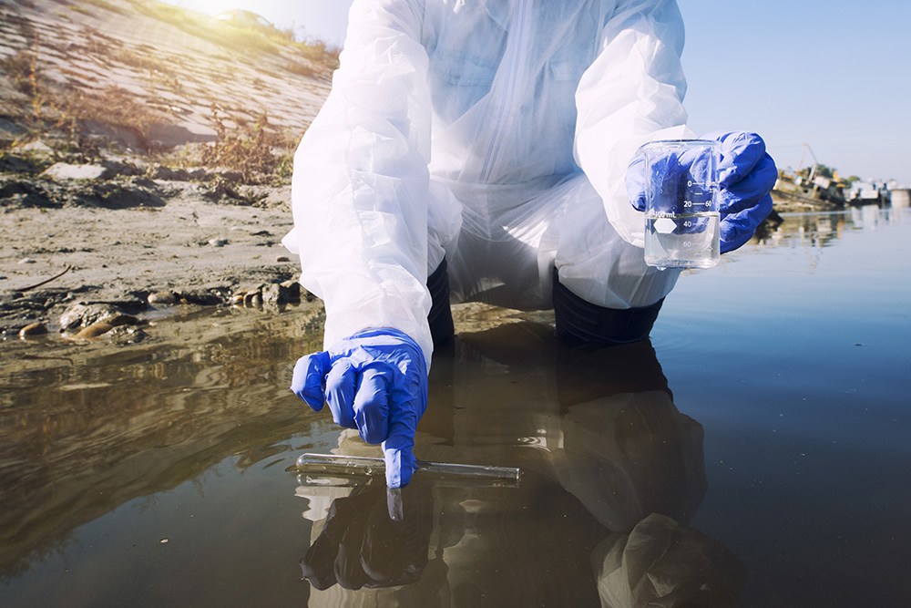
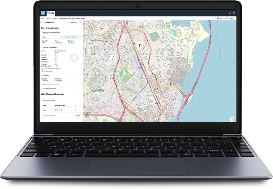
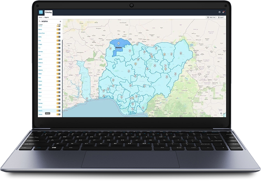
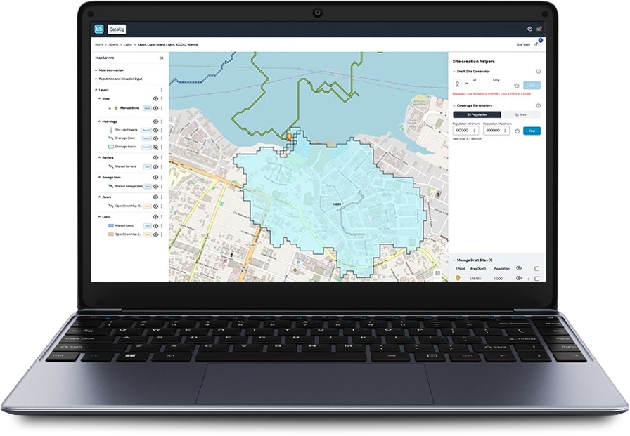
The Environmental Surveillance Catalog allows users to collect georeferenced data in the field and maintain an inventory of environmental sampling sites for any disease in a user-friendly interface.
The hydrological model underlying the solution uses topography and elevation data to estimate stream networks and to delineate the area that contributes sewage for each sampling location. This allows users to identify possible new sampling sites.
Man made sewers, waterways or underground pipes can be integrated to improve the accuracy of the model.
The solution uses publicly available population models to estimate the number of people within an area that contribute to a sample. Population estimates can be used to plan an effective vaccination campaign or other intervention in the areas at risk if an environmental sample tests positive.
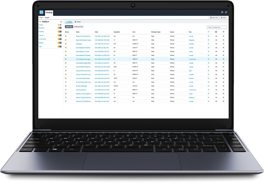
48
Countries
1K+
Environmental Sites
250
Cities

They talk about it
More information

Geographic deployment
Environmental Surveillance is a global solution accessible publicly, worldwide
Context
Traditional monitoring of polio virus circulation in a population through reporting observed acute flaccid paralysis cases can be inadequate since 99.5% of infected people are asymptomatic.
However, since the virus is shed in faeces of every infected individual, sewage monitoring can give an accurate picture of a community’s viral contamination. More recently, sewage monitoring has become relevant for other viruses like COVID-19.