Objectives
- Generate digital microplans based on up-to-date geospatial information
- Allow field staff to update the underlying geospatial data, while offline in the field
- Allocate populated areas automatically to health facilities
- Use settlement and population data derived from recent satellite imagery to better plan supply stocks
- Easily identify populations not within reach of health services
- Produce detailed, accurate, printable microplan maps and tables
- Easily monitor the planning process in real-time
- Please find a short demo video of the main features here.
Description
The Geospatial Microplanning Toolkit (GMT) combines up-to-date information for settlements, populations and health facilities in a digital tool that vastly improves the microplanning process.
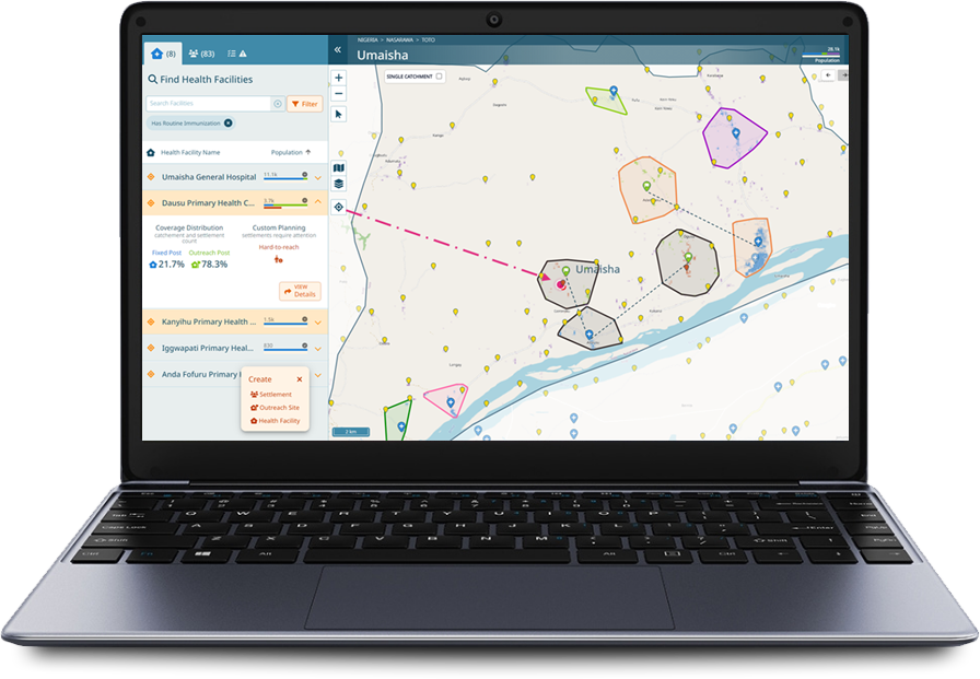
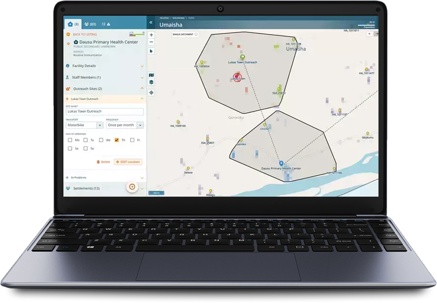
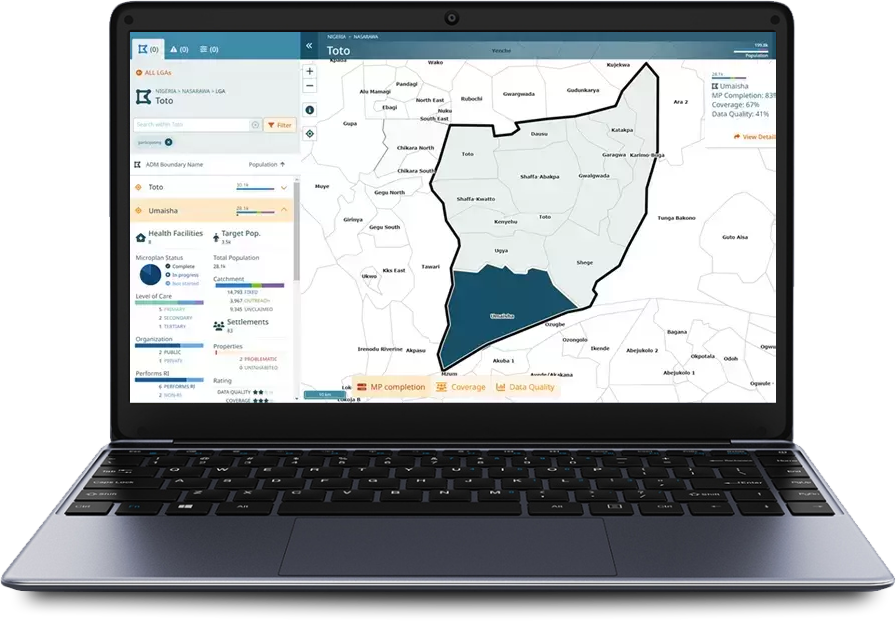
Public health officials can access a list of settlements and view their geographic placement and extents in an easy-to-use map interface. GMT automatically identifies a settlement as ‘unclaimed’ if it is beyond the reach of an existing health facility. Planners can add new service delivery locations to the map to ‘claim’ settlements, ensuring that the greatest number of people receive health services. The tool dynamically updates the population attributed to each health facility as changes are made.
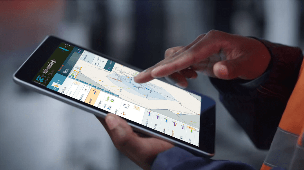
Planners can pull the latest relevant geospatial data and take the tool offline via computer or tablet to create and edit microplans, export as PDF maps or use the data to track and monitor in other tools such as GTS. Users can make changes to the base map – edit or add settlements and health facilities – and sync those changes back to the GMT geospatial database once reconnected.
17
LGAs
193
Wards
821
Health facilities

They talk about it
More information

Geographic deployment
Nigeria
Context
A typical microplan captures details about how public health services are delivered in the field – often supported by a hand-sketched map which identifies health facilities and the settlements covered by the plan. The microplan depicts where health services will be delivered. It enables health facilities to determine the population within their catchments and organize the necessary supplies and staff required to deliver the health services. A health facility may have different catchment areas for specific services, requiring specific maps.
The traditional paper microplans represent the best offline information available at the time and do not typically depict accurate distance and geographic features. These plans omit recent updates and do not easily display information across different health administrative areas, resulting in underserved or over-served communities.